
Dangerous Waters
North Carolina photographer Micah Cash sets out to document the cultural shifts that have come in the 75-plus years since one of the world’s largest public works projects altered the course of the American South — the Tennessee Valley Authority.
Some of them made their living cutting the timber down
Snaking it one log at a time up the hill and into town.
T.V.A. had a way to clear it off real fast.
Lots of men and machinery, build a dam, and drown the rest.
—
“Uncle Frank,” 1999, Mike Cooley, Drive-By Truckers

For his living, photographer Micah Cash teaches at the University of North Carolina-Charlotte’s College of Arts + Architecture. But the art he creates with his own cameras focuses on a topic far more specific than the typical photographer’s. “I’m concerned with how land use influences cultural geography,” he says.
That means Cash focuses his art on getting underneath what happens to our culture and our people when the landscapes around them change. Cash’s most recent work focuses on one of the greatest sources of landscape alterations in American history — the Tennessee Valley Authority. Established in the middle of the Great Depression as part of President Franklin D. Roosevelt’s New Deal, the TVA brought electricity and modern conveniences to impoverished rural areas across a wide swath of the South. But in the process, it displaced more than 14,000 families. Those stories have fueled thousands of works of art — from films like the Coen brothers’ “O Brother, Where Art Thou?” to songs like Mike Cooley’s “Uncle Frank.” But the stories from the other side fed the culture, too, which is how, a few years after Cooley’s song, Jason Isbell penned his own “TVA” during his time in the same band. “Thank God for the TVA,” Isbell sang. “Where Roosevelt let us all work for an honest day's pay.”
How people reacted to the TVA, in other words, depended on whether you were a displaced logger or a newly employed dam builder. The TVA, in its way, is the largest manifestation of the duality of the Southern thing.
And that’s the territory Cash explores with these photographs.
“As a Southerner, it made perfect sense to start with TVA,” Cash says. “Not only did it radically change the culture and topography of the South, but it was used as a model throughout the world. What fascinates me most about TVA — and its story in the region — is the people: the armies of construction workers in the 1930s and ’40s, the TVA employees who continue to proclaim the agency’s social mission, and the people of the valley who have nuanced and complicated relationships with the agency.”
Beginning in early 2013, the project eventually saw Cash visiting every dam, embankment and hydroelectric facility within the TVA system.
“One of the joys of this project has been talking to people who have close, personal attachment to these dams: They grew up close to them, vacationed at them, or worked to keep them in operation,” Cash says. “Even if I did not make photographs at every location, I needed to understand the conflicting nature of TVA and contemplate what was gained as well as what was sacrificed. This included talking to as many people as I could within those locations.”
The result is “Dangerous Waters,” which will be expanded and published in book form by the University of Tennessee Press next year. It’s a remarkable body of work, and The Bitter Southerner is happy to share it with you today.
— Chuck Reece

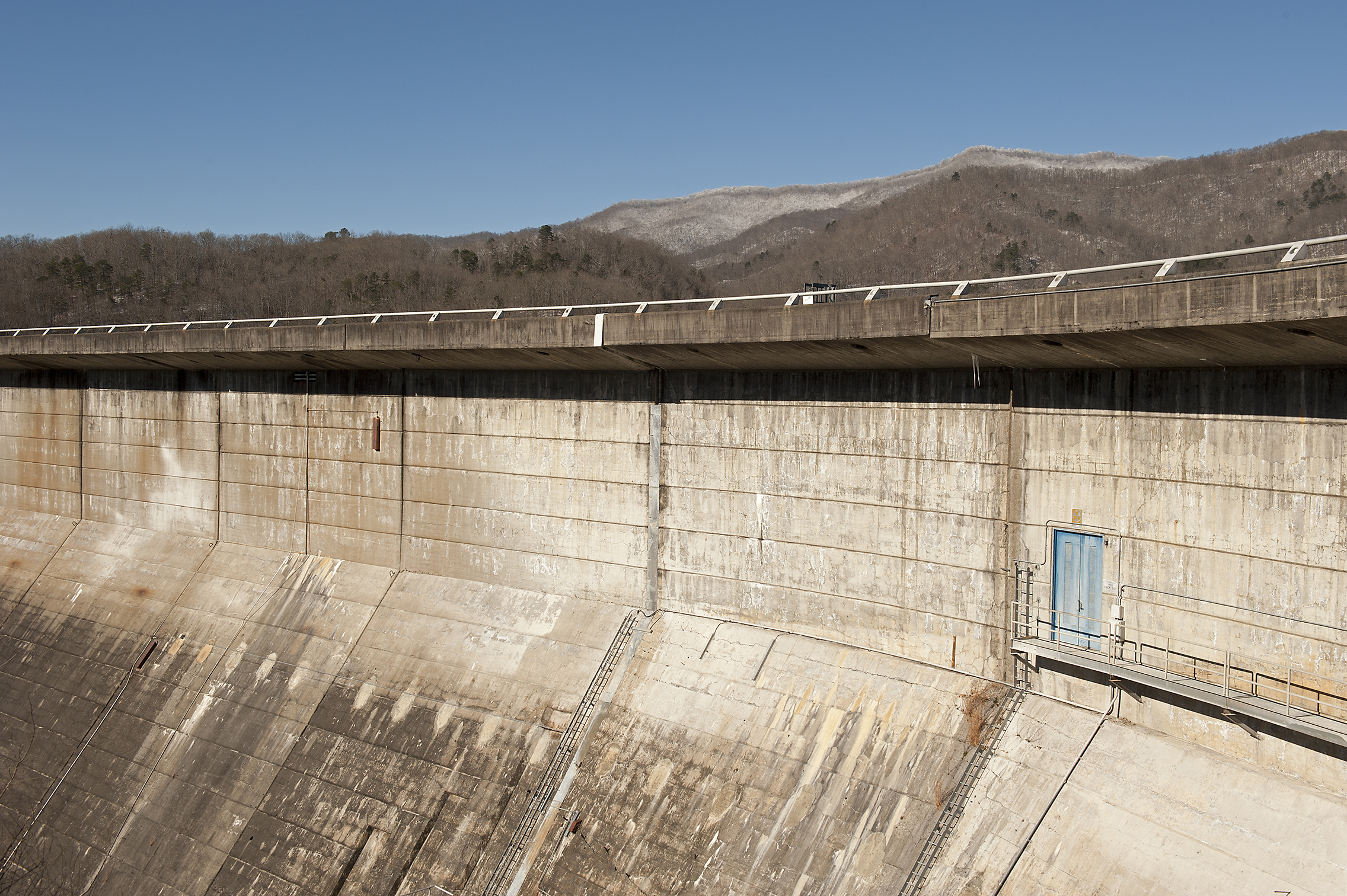
Little Bear Creek, Reservoir — 2014. Little Bear Creek Dam is a flood control structure in northwest Alabama. While not a hydroelectric facility, the dam contains a single intake tower. It was completed in 1975.

This collection of photographs investigates the contemporary landscapes of the Tennessee Valley Authority's hydroelectric program and considers the tenuous balance between locations that are designed for both hydroelectric generation and public recreation.
Fully informed by TVA’s history, my focus is to visualize how these locations are culturally and socially defined four generations after their creation. The resulting images interpret TVA’s built environment and actively question how these highly engineered landscapes are utilized by both the community and the utility company that operates them. While these dams have become symbols of social and economic prosperity, they also remain visual reminders of loss, population removal and eminent domain. The accompanying recreational land is a civic contract to the descendants of those families that were relocated and to the memory of inundated ancestral land.
When President Franklin Delano Roosevelt created TVA in 1933, progress was the initiative, and transformation of the Tennessee River watershed was necessary. Annual floods ravaged the region, isolated rural populations were without electricity, and large sections of the Tennessee River remained impassible and unreliable due to rocky shoals and intermittent flooding. The Valley was to be the birthplace of a social and political experiment, an initiative that became one of the largest physical landscape transformations in American history. The corporation that emerged was one of idealism and reassurance: employment and opportunity, people before profit, government as benevolent, as well as affordable and abundant electricity. The social cost of such regional development was significant: whole towns had to be sacrificed, over 14,000 families were removed, 1.3 million acres were purchased through eminent domain, and approximately 20,000 graves were relocated. Fertile river-bottom farmland was washed over in the name of progress and modernity.
The central narrative of "Dangerous Waters" is not about the architecture itself, but the places that have been created by the structures’ function. It is a visual conversation about the public space of TVA’s hydroelectric program. It casts a wide net, and includes imagery from across TVA’s seven-state service area, from the smallest flood control embankments to the largest main river dams. It also contains photographs from locations that are uniquely bound to the agency through consequence, such as state and national parks that exist on land acquired by TVA through eminent domain. Ultimately, these photographs document the locations as they are today, not as they were during the Great Depression or at the advent of nuclear power in the 1970s, but as culturally relevant locations that are colored by the past, yet often overlooked in the present.
— Micah Cash
Douglas, Visitor Center — 2014
Located in Sevier County, Tennessee, Douglas Dam is a hydroelectric facility on the French Broad River. This open-air overlook lies north of the dam at a large picnic area that overlooks the dam and its reservoir. Douglas Dam was constructed in only 382 days, and was completed in 1943.
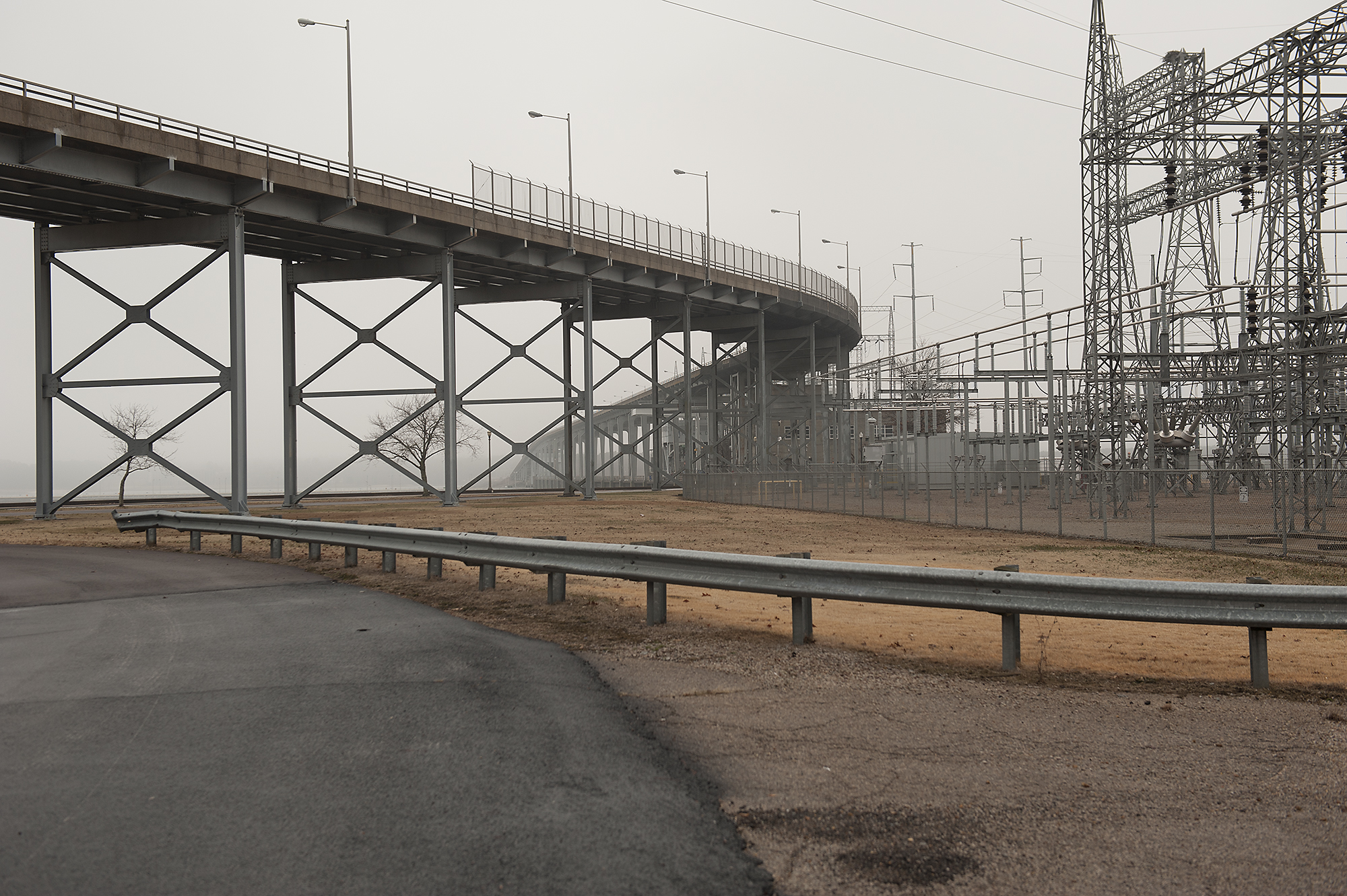
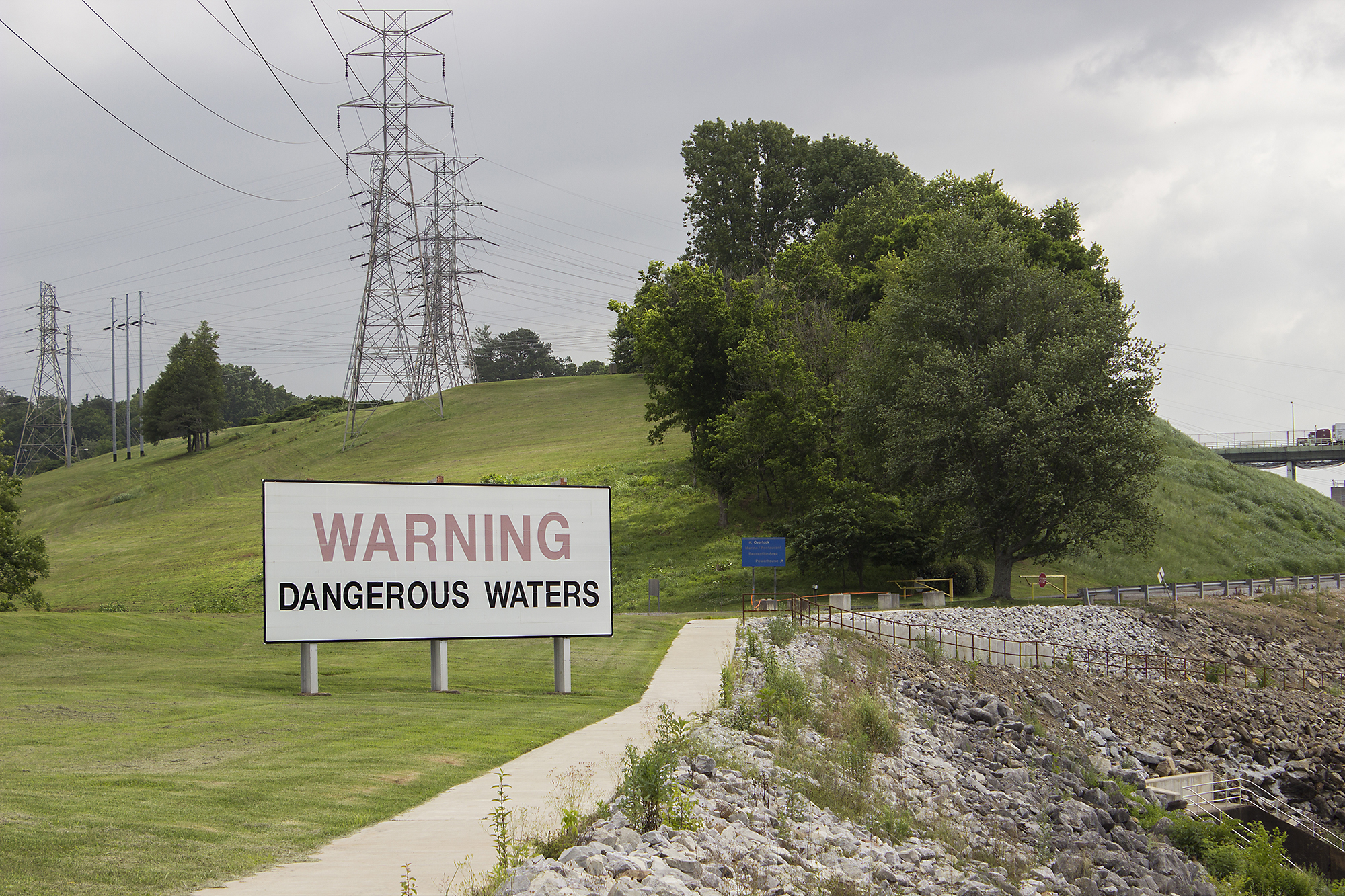
Pickwick Landing — 2014
The reverse of a “Dangerous Waters” billboard faces downstream of Pickwick Landing Dam. One of nine TVA dams on the Tennessee River, Pickwick Landing is located in Hardin County, Tennessee. The dam’s switchyard is situated next to the powerhouse parking lot. Tennessee Highway 128 curls over the dam’s reservation from the left and across the Tennessee River. Pickwick Landing Dam was completed in 1938.

Raccoon Mountain, Discharge Tunnel — 2015
Raccoon Mountain Pumped-Storage Plant contains a mountaintop reservoir that is drained during peak electricity demand. The discharge tunnel, pictured here, also operates as the intake location when the reservoir is refilled.
Raccoon Mountain — 2015
Located on the Tennessee River, this structure surrounds the intake/discharge tunnel at the foot of Raccoon Mountain Pumped-Storage Plant. The facility contains four generating units inside the mountain and was completed in 1978.

South Holston, Visitor Center — 2013
This facility, which had been closed since 2001, was reopened to the public in 2015. Despite its vacant and locked status, the building was an architectural accent at the top of the dam when this photograph was made in 2013.
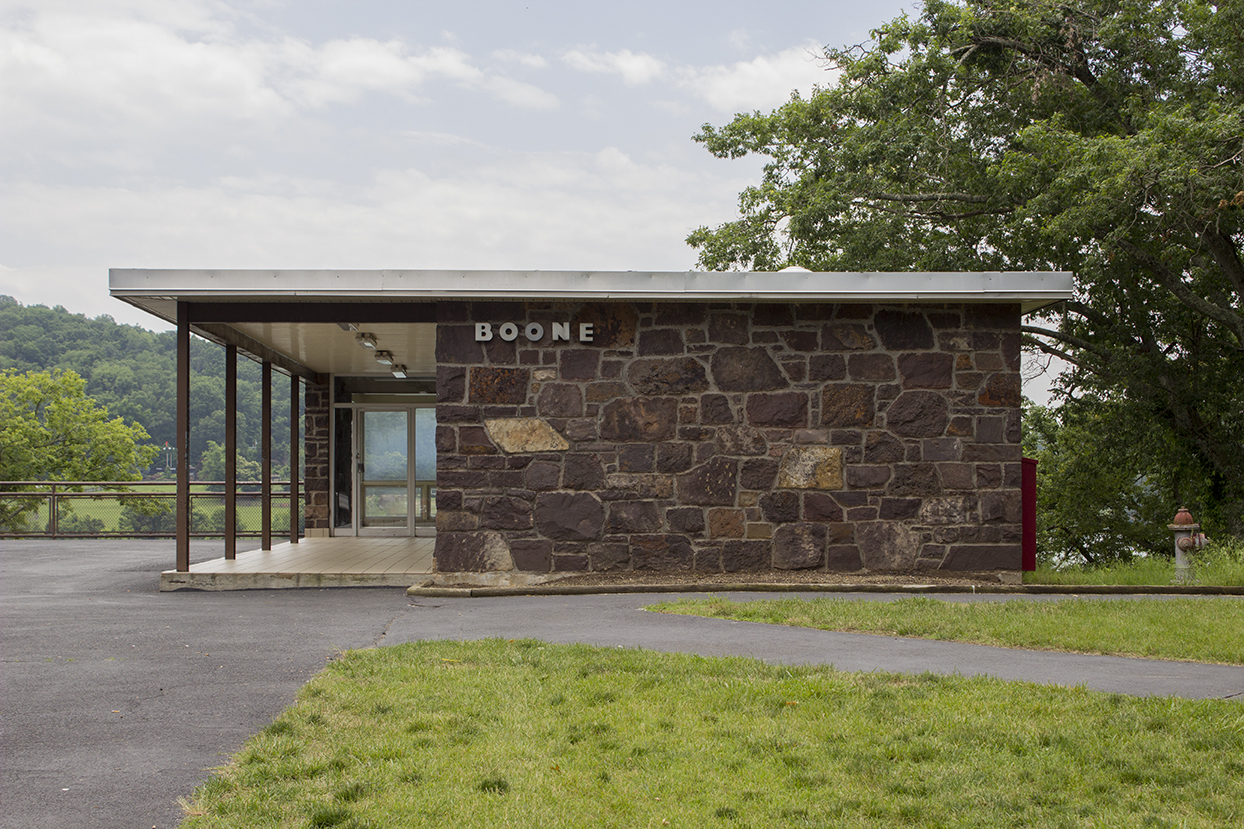

Boone, Recreation Area — 2013
Boone Dam is located on the border of Sullivan and Washington counties in Tennessee. This photograph of the dam’s main recreation area was made on a busy Saturday in June of 2013. The dam is currently under extensive construction to remediate a significant seepage issue, requiring low reservoir levels for the next five to seven years. Boone Dam was completed in 1952.

Apalachia, Reservation — 2015.
Apalachia Dam is located in Cherokee County, North Carolina. Located on the Hiwassee River, this large steel penstock carries water to the dam’s powerhouse in Polk County, Tennessee. The dam was completed in 1943.

Dogwood — 2015
Dogwood Dam is a flood control facility within the Beech River watershed. It has no hydroelectric components. In Henderson County, Tennessee, it was completed in 1965.

Wilson, Downstream — 2015
A family spends the afternoon fishing under a “Dangerous Waters” billboard directly downstream from Wilson Dam’s powerhouse. Located near Florence, Alabama, Wilson Dam was completed in 1924 and contains 21 generating units.
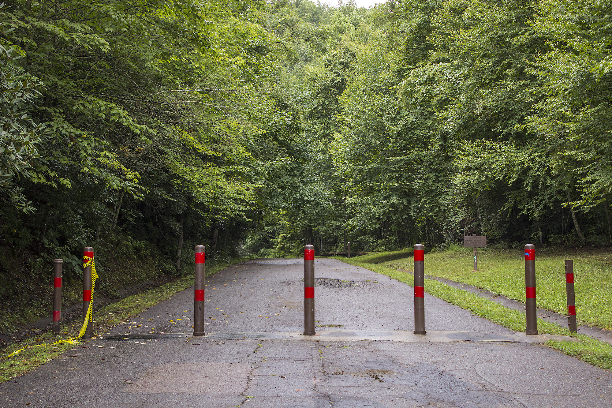
Fontana, Lakeview Drive — 2015
The construction of Fontana Dam inundated Old Highway 288 and necessitated the removal of communities along the north shore of the newly-created Fontana Lake. A new road was proposed to allow access to the family and community cemeteries that were ultimately annexed into Great Smoky Mountains National Park. Lakeview Drive was never completed, and ends at a tunnel approximately six miles into the park. These pylons mark the end of the locally named Road to Nowhere and the beginning of the park's Lakeshore Trail.
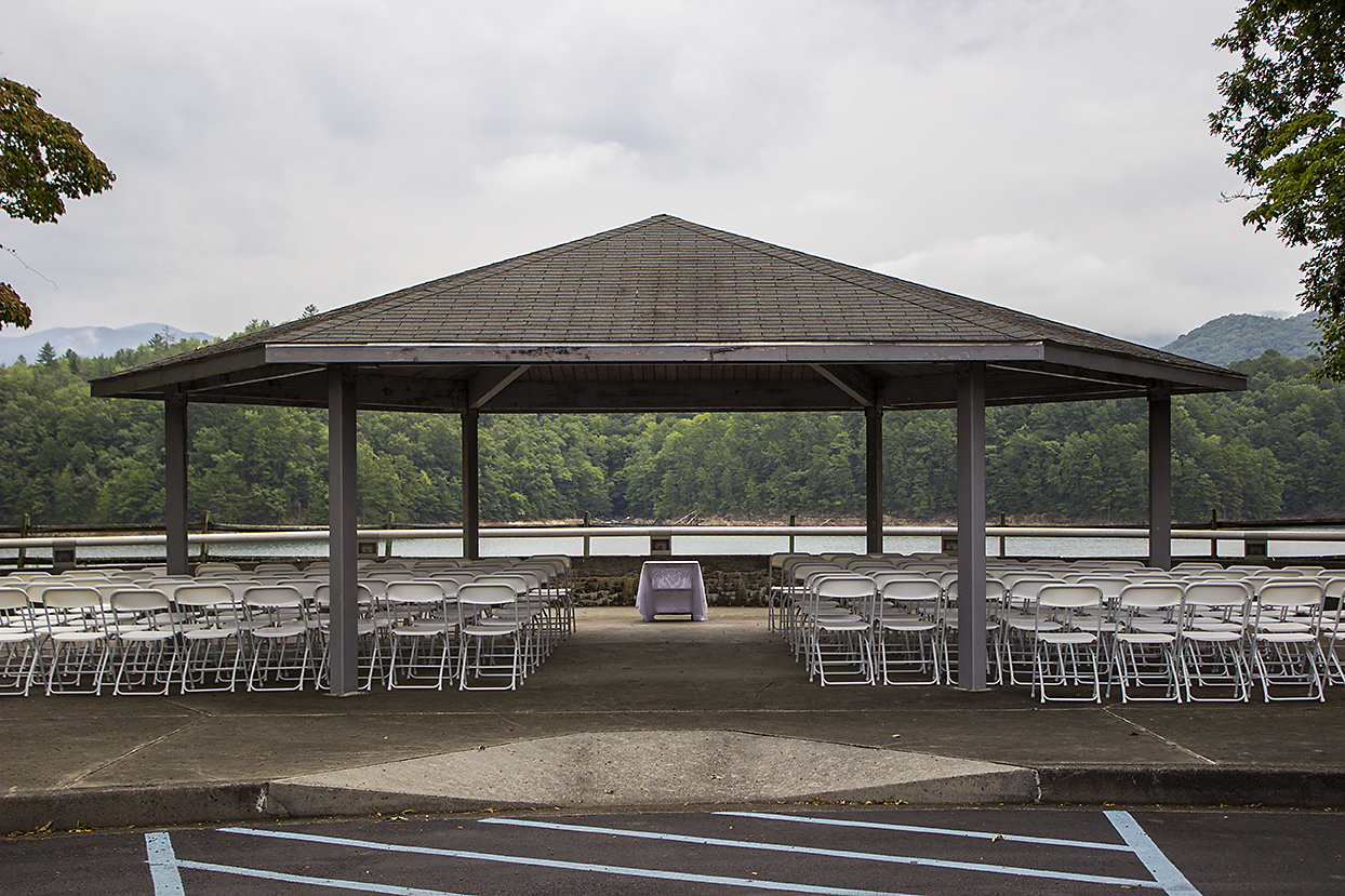
Fontana, Reservoir Overlook — 2015
This pavilion, which is located near the Fontana Dam Visitor Center, was in the process of being decorated for a wedding. Fontana Dam impounds the Little Tennessee River.

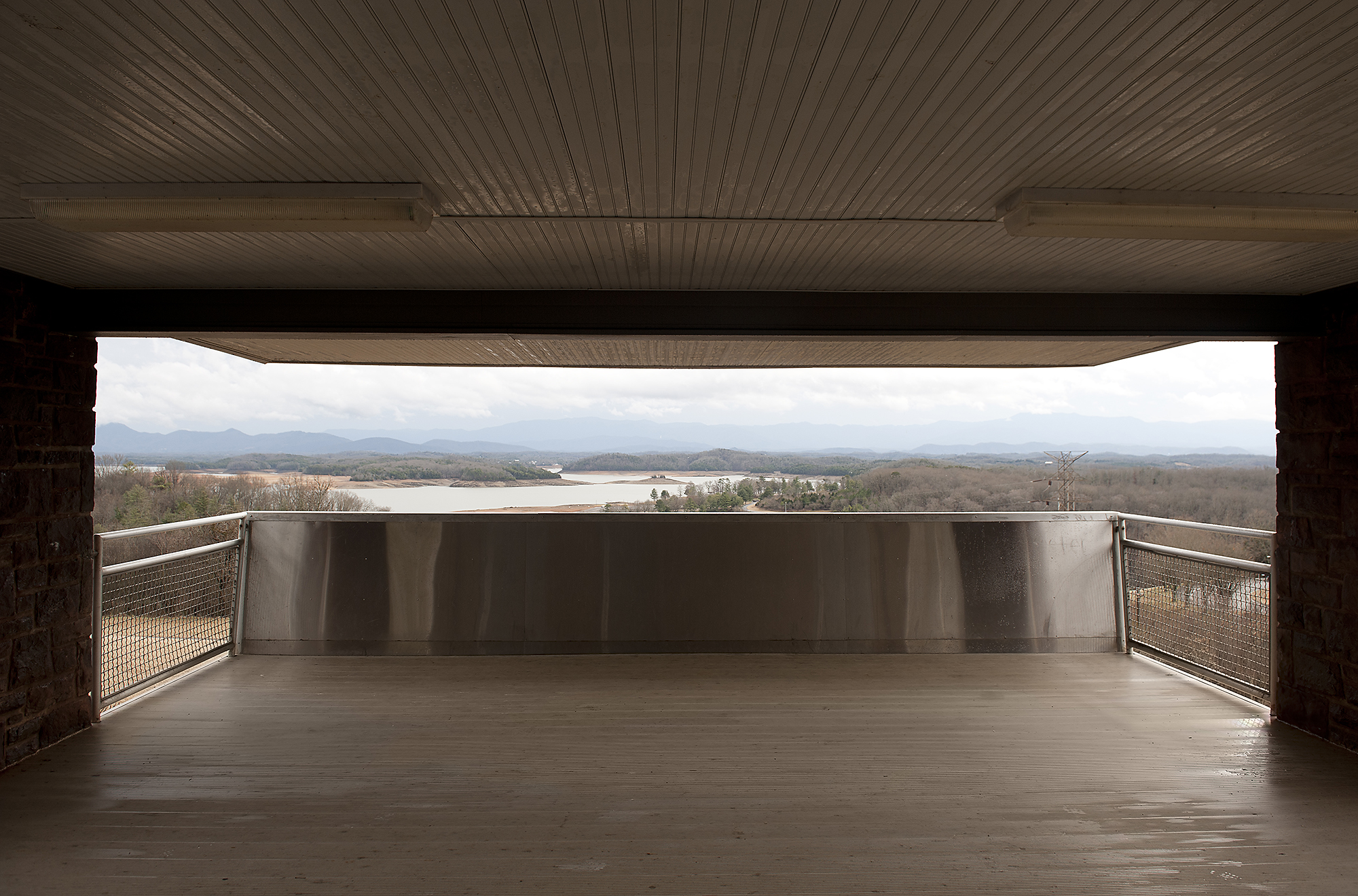
Fontana, Visitor Center — 2013
This photograph was made from inside Fontana Dam’s Visitor Center, and looks out toward the dam. Many of TVA’s dams were designed as tourist attractions and include separate visitor center facilities with maps, historical information and documentary videos.
Fontana — 2014
The tallest dam in the eastern United States, Fontana Dam stands 480 feet tall and was completed in 1944. Located in both Swain and Graham counties in North Carolina, the dam’s reservoir borders Great Smoky Mountains National Park.
Ocoee No. 1 — 2015
Completed in 1911, Ocoee Dam Number 1 was acquired by TVA in 1939 from TEPCO. Ocoee 1 is located in Polk County, Tennessee. This photograph was made at Sugarloaf Mountain State Park, which is directly downstream of the dam.
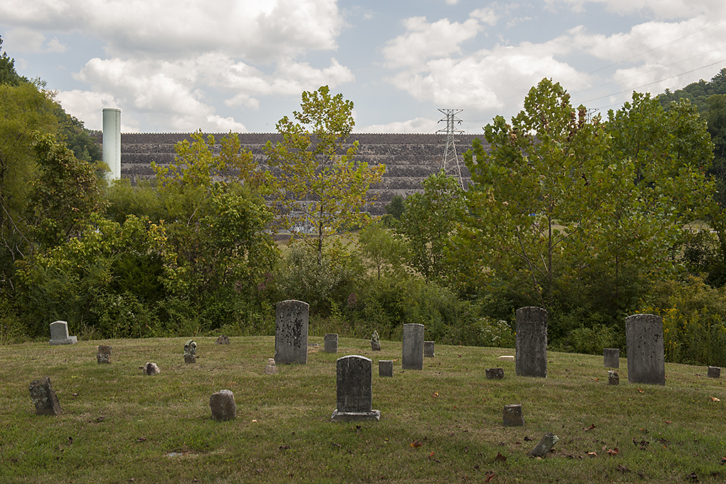
South Holston — 2014
Located in Sullivan County, Tennessee, South Holston Dam was completed in 1950. The dam stands 285 feet tall and contains one generating unit. This small cemetery lies directly downstream of the dam.

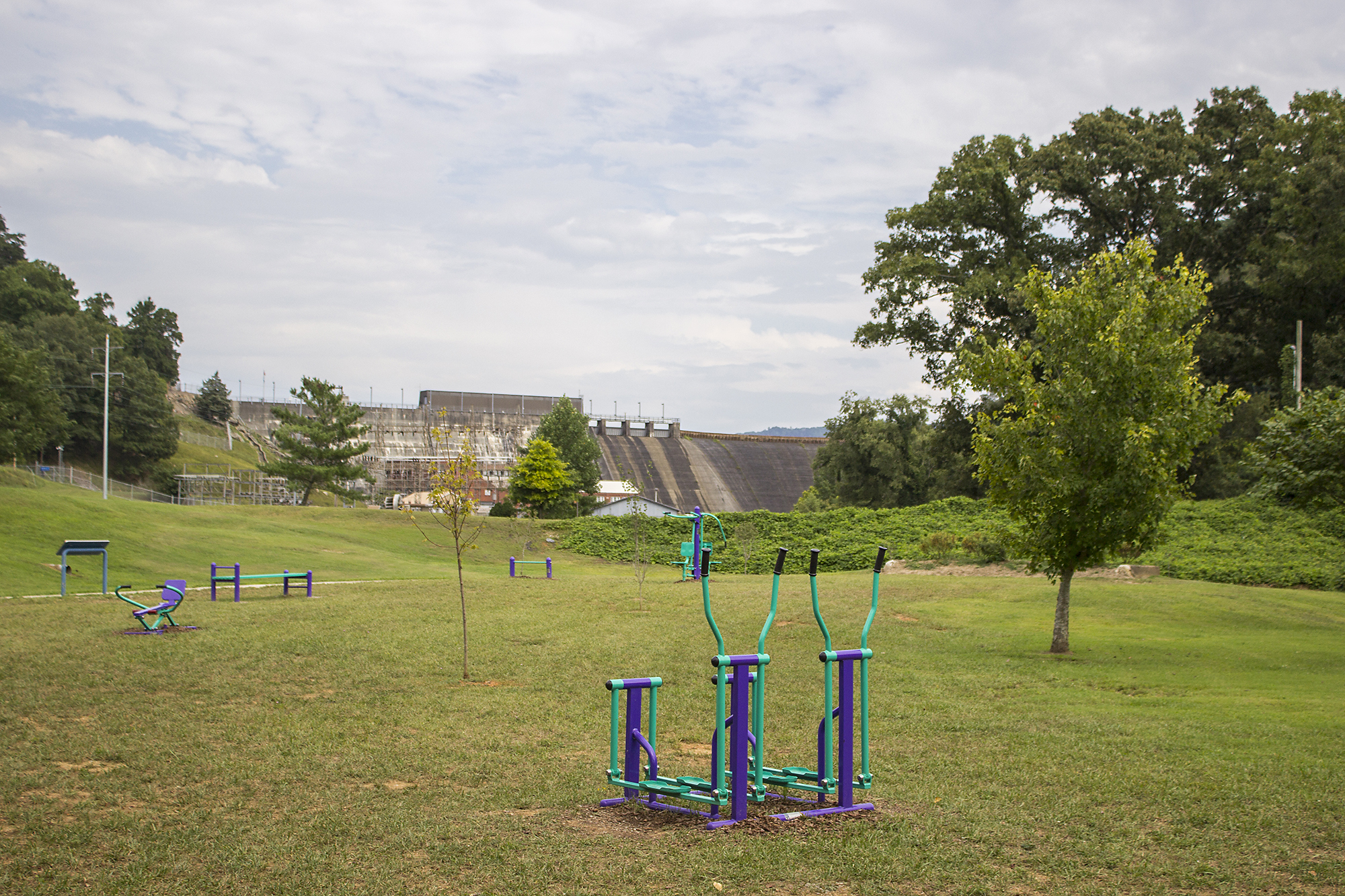
Big Ridge State Park, Swimming Area — 2015
Big Ridge State Park was created by TVA, the Civilian Conservation Corps and the National Park Service as a demonstration recreational area. A component of the larger Norris Project in the 1930s, it continues to offer a variety of recreational opportunities.

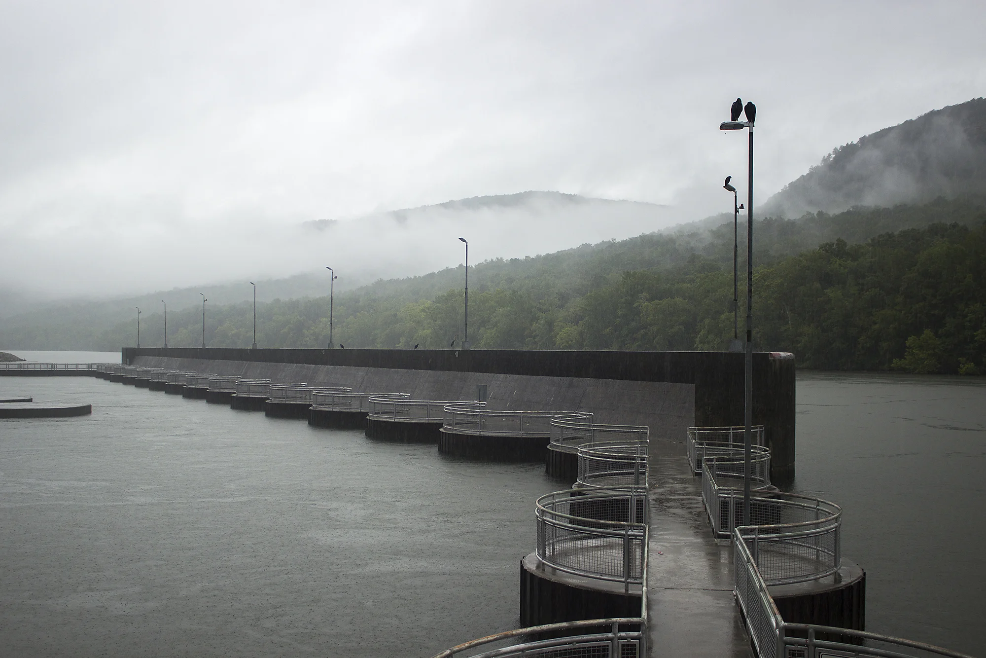
Norris — 2013
The first dam constructed after TVA’s founding in 1933, Norris is 265 feet high and impounds the Clinch River. It is located in Anderson and Campbell counties in Tennessee. It was completed in 1936. This photograph looks down Norris’s spillway from atop the dam.

Norris, Marina — 2013
This quarry is currently home to Norris Dam Marina. The stone used to construct Norris Dam was acquired from this location.

Watauga, Visitor Center — 2014
Watauga Dam is located within Cherokee National Forest in Carter County, Tennessee. This view into the dam’s visitor center shows a display panel that discusses the inundated town of Butler, which was relocated in 1948 as Watauga Dam was completed.

Nickajack, Downstream — 2014
This overgrown service area was photographed downstream of Nickajack Dam. Located adjacent to a crumbling parking lot, the two blue signs are the only acknowledgement of TVA ownership. Nickajack Dam is located in Marion County, Tennessee, and impounds the Tennessee River. It was completed in 1967.

Chickamauga, Downstream — 2014
A bench offers a place of observation and respite downstream from Chickamauga Dam’s powerhouse. Situated on the Tennessee River, the dam is located in Chattanooga, Tennessee. It was completed in 1940.
Douglas, Recreation Area — 2014
Situated near Douglas Dam, this swimming area offers a vista with unlikely imagery: beach sand and the Appalachian Mountains.

Tims Ford — 2013
Tims Ford Dam was completed in 1970 and is situated on the Elk River in Franklin County, Tennessee. This photograph looks toward the dam from its downstream parking area.

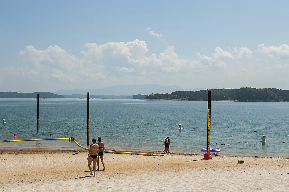
Tellico, Reservoir — 2013
This photograph, made from inside one of Tellico’s swimming areas, contemplates the legacy of Tellico Dam and the cultural, ecological and political ramifications the filling of this reservoir caused. Tellico Dam is located in Loudoun County, Tennessee, and impounds a portion of the Little Tennessee River. It was completed in 1979.
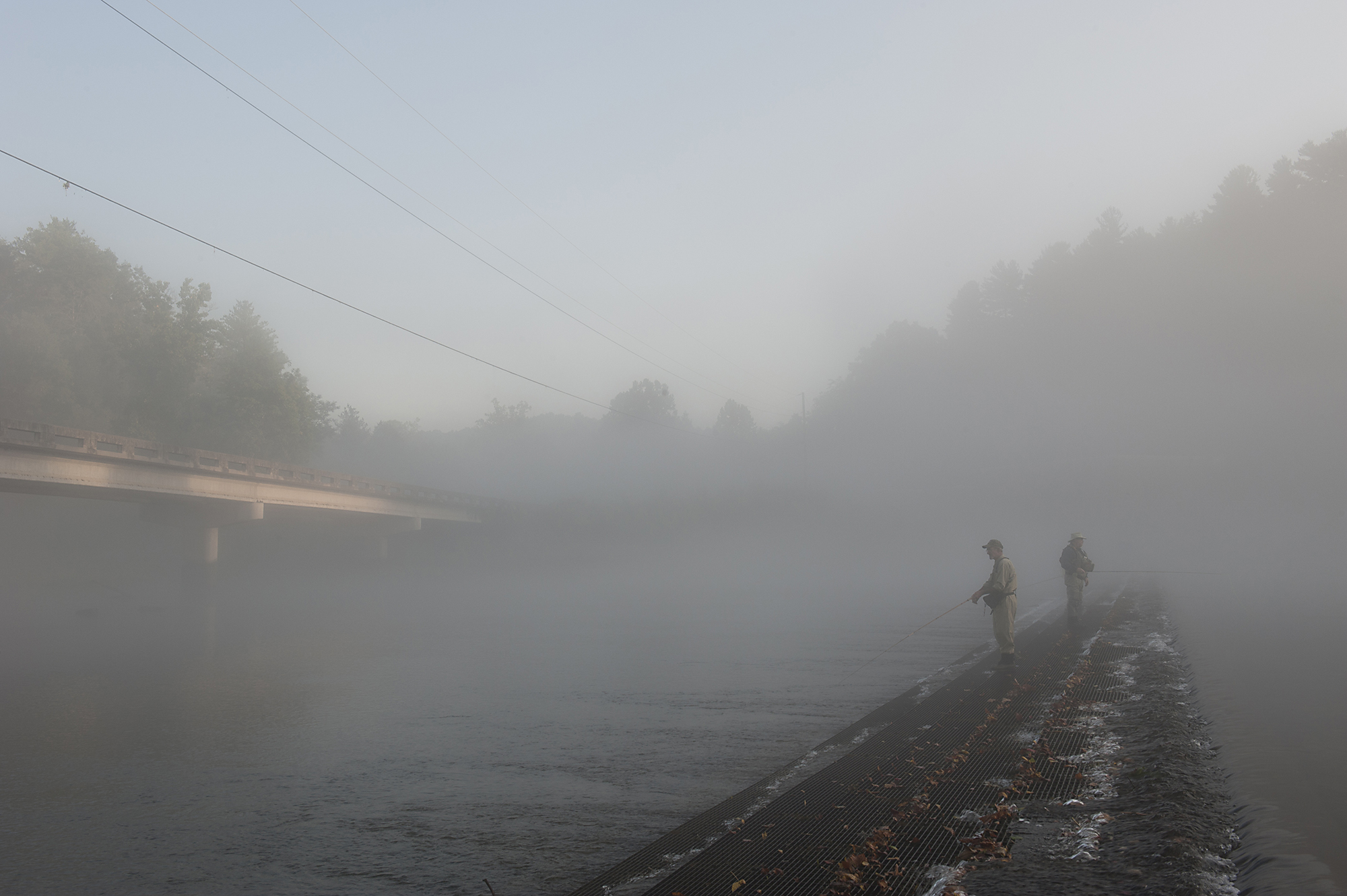
South Holston, Downstream — 2014
Surrounded by the visual presence of industry, fishermen stand on a weir downstream of South Holston Dam. The South Fork Holston River is a popular location for trout fishing.
